Professional Land Surveying and Engineering Services in East TN
Sterling Engineering, Inc. in Maryville, TN, offers professional land surveying and engineering services for both residential and commercial projects. Our dedicated team is ready to help you with all of your land surveying and engineering needs in and throughout East Tennessee. Call us today at 865-984-3905 to learn more or to get started.
Engineering and Surveying Services
Our diverse areas of expertise are designed to fit the changing needs of your project.

- Aquatic Resource Alteration Permit (ARAP)
- Concept Plans
- Consultation
- Drainage and Stormwater
- Erosion Control Design
- FEMA Flood Analysis
- Grading
- Residential and Commercial Site Plans
- Road Designs
- Roads
- Sanitary Sewer and Pump Station Design
- Septic Systems
- Sewer Collection
- Site Development Planning
- Site Feasibility Study
- Site Planning & Design
- Storm Drainage Design
- TVA Permitting
- Water Distribution
- Water System Design

- Amenities Planning/Permitting
- Commercial Sites and Developments
- Concept Plans
- Development Feasibility Studies
- Industrial Sites and Developments
- Land Planning
- Master Planning
- Residential Developments
- Site Feasibility Study
- Site Utilization Studies

- ALTA/ACSM Land Survey
- As-Built Survey
- Boundary Survey
- Building Stakeout
- Construction Staking
- Construction Survey
- Control Survey
- Easements and Legal Descriptions
- Elevation Certificates
- Engineering Survey
- FEMA Flood Analysis
- FEMA LOMA, LOMR, and LOMR-F
- Lot Survey
- Mortgage Loan Survey
- Property Division or Replats
- Topographic Survey
We specialize in a range of key services that form the core of our work, including
- Boundary Surveys: Accurate determination of property lines for residential and commercial properties.
- Subdivision Design: Comprehensive planning and layout for new developments.
- Site Planning: Tailored solutions for site preparation and optimization.
- ALTA Surveys: Detailed surveys meeting American Land Title Association standards, ideal for commercial transactions.
Why Choose Our Engineering and Surveying?
Over 45 years of experience providing comprehensive land development solutions, from initial surveying to full engineering design.
Committed to delivering the highest quality service with a focus on client satisfaction and building a better tomorrow.
Professional, timely, and efficient project delivery, ensuring deadlines are met without compromising accuracy.
Fair and competitive pricing for all services, backed by expertise in working with local municipalities, state agencies, and regulators.
Engineering and Surveying Reviews
Here are some recent customer reviews highlighting our commitment to excellence:

Happy with our service? Feel free to leave us a review.
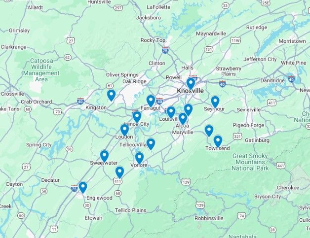
Engineering and Surveying Service Area
We proudly serve clients across Blount County, Knox County, and surrounding areas in East Tennessee, including cities within a 30-mile radius of Maryville, such as the following:
- Alcoa
- Athens
- Farragut
- Greenback
- Knoxville
- Lenoir City
- Loudon
- Louisville
- Madisonville
- Rockford
- Seymour
- Sweetwater
- Townsend
- Vonore
- Walland
- And nearby communities
What Type of Land Survey Is Right for Me?
You've been advised to get a survey, but where do you start? What exactly is required, and what isn't? We'll address several typical scenarios in the sections below. If your specific case isn't covered here, feel free to outline your circumstances on our contact page.
I've lost track of my property markers. What should I do?
This is typically one of our simplest offerings. We'll review property records, perform fieldwork to locate the points, and stake them out clearly. You can opt for this with or without an official documented plan of the results.
There's a disagreement with my neighbor over our common boundary. How to proceed?
Getting a survey can clarify the issue. Our team will visit the site, measure the surrounding parcels, produce a diagram highlighting any intrusions or overlaps (if present), and precisely indicate the line's position. In many cases, this resolves tensions before they escalate to legal action.
My local zoning department requires a site layout for my home construction. What's that about?
Standards differ by area. It might just involve illustrating your planned building or extension on the parcel. But it could also require contour lines depicting terrain height, intended services, or additional developments.
I own a large parcel and plan to transfer portions to family members. What's the process?
We begin with a perimeter assessment to validate all edges and overall size. After you share your rough division preferences, we'll draft a plan for evaluation by the relevant approval body. Following your and their endorsement, it can be filed officially. Parcels staying above 5 acres generally skip the review board. Splits creating lots below 5 acres need board oversight.
The lender demands a survey for my recent land buy. What specifics are they after?
Banks usually want an up-to-date assessment to back your financing or building funds. Many also mandate a base check to ensure the structure doesn't violate spacing rules.
I'm putting my land on the market, and the potential buyer wants a survey. What can I anticipate?
During sales, a perimeter review is common to verify measurements, limits, and any intrusions or access rights for the purchaser. This minimizes unexpected problems and facilitates the deal. Our service includes a verified diagram with key elements like current buildings, lines, or land use rules.
I'd like to put up a barrier on my boundary. Should I survey beforehand?
Absolutely, a perimeter check is advised to pinpoint lines exactly and sidestep conflicts. We'll flag key points and paths, making sure the installation aligns with regulations and avoids future expenses or disputes.
My area could be flood-risk. Which survey helps with coverage or development?
A height assessment or flood level document is key. We'll gauge the ground's shape and heights against risk areas, aiding in risk evaluation and insurance needs. This is frequently mandatory for funding or protection in vulnerable locations.
I'm considering an addition like a porch, terrace, or swimming area. Do I require a survey?
A location diagram or terrain map confirms adherence to spacing, rules, and avoids overlaps with rights or edges. We'll chart heights, current items, and new ideas to support approvals and work, preventing fines or changes.
I'm buying raw acreage. What assessment is best for checks?
A combined perimeter and terrain review is recommended pre-purchase. It checks area, marks limits, spots intrusions, rights, or natural aspects like marshes, and evaluates ground for building viability. This safeguards your funds by spotting concerns upfront.
I think there might be access paths or allowances on my land. How does a survey assist?
A perimeter review including allowance checks will identify and note any official paths, service rights, or entries impacting your area. We'll examine documents and plot them, clarifying limits and aiding your strategies.
I'm updating my home loan, and the provider needs a survey. What does it entail?
Providers often seek a detailed ALTA/NSPS review or fresh perimeter check for updates to validate details and flag risks like overlaps. This thorough process covers record checks, marking, and a comprehensive chart of enhancements, services, and possible concerns.
I'm launching a yard redesign or upgrade with excavation or leveling. Is a survey necessary?
A terrain map outlines the ground's shapes, heights, and traits, ensuring your efforts handle flow, inclines, and limits. It's vital to dodge buried lines, soil loss, or adjacent issues, particularly with major changes.
I'd like to split my acreage for building or resale (not just family). What are the stages?
Like kinship splits, commence with a perimeter review to set edges and size. Next, we'll prepare a division layout displaying intended sections, paths, and services for board clearance. Rules differ by scale and location, commonly including terrain info for setup design.
Contact Our Team
Ready to discuss your project? Fill out the form below, and we'll get back to you promptly.


